
North Face Route
Recommended Route Name: North Face Route
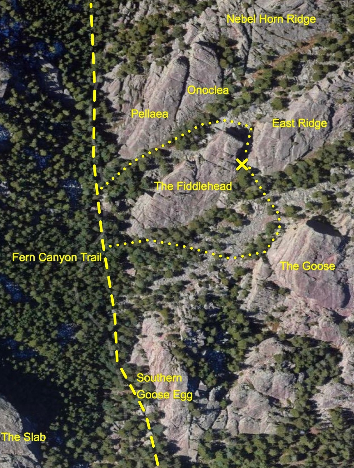
Rock Formation: The Fiddlehead, Fern Canyon
Number of bolts to be placed: 8 lead bolts and a 2 bolt anchor
Estimated Difficulty: 5.11
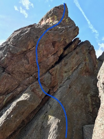
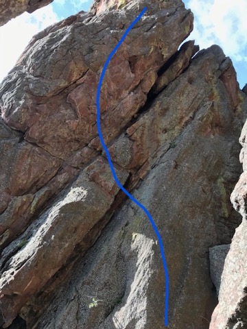
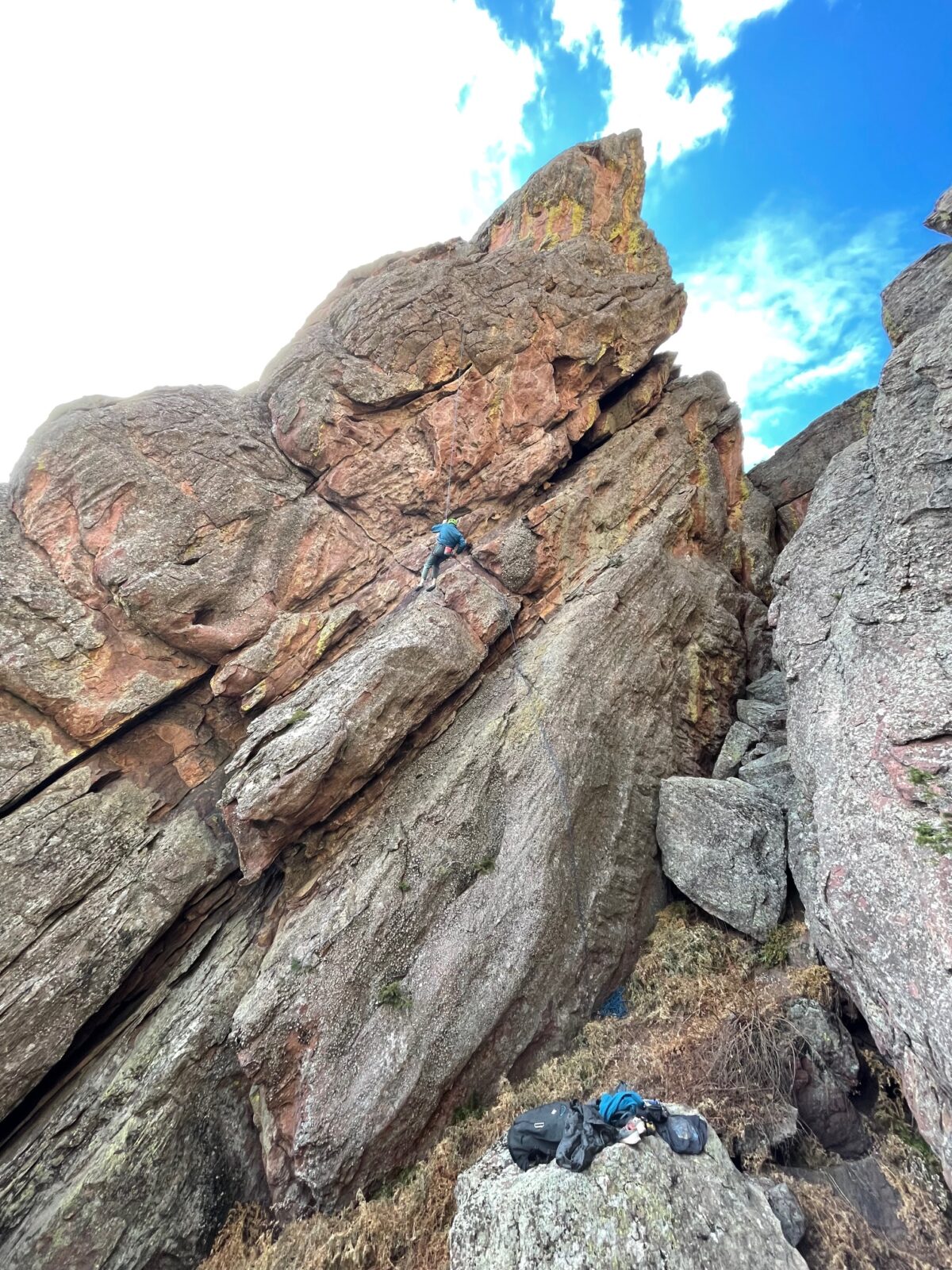
The North Face Route is on the North Face (hence the name). It starts with a steep slab and heads up blocky terrain. Steep hueco hauling lead to a rising traverse to the right on really fun alligator skin (in-cut jugs). Aim for a tufa feature leading to the top of the formation and the anchor. Lower back to the base, 70m rope mandatory. There is a lot of natural gear placements along the route. Bolts will only protect the sections without reliable trad gear.
A description of existing routes on the same face of the rock formation, including the number of routes, route names, route grade, type, and approximate distance between routes (a photocopy or diagram of the existing route(s) is also required):
The Fiddlehead formation currently has 13 routes. Most routes are a mixed with bolts and traditional gear required for protection.
Fiddlehead East Face 5.4 Trad, Men Only 5.10c Trad, Fiddlehead project (no grade) Bolted, Fertile Crescent 5.11d Mixed, Castles Made of Sand 5.12a Bolted, A Shadow Sickness 5.10a Trad, Clarence 5.10c Trad, Stemadilemma 5.11d Mixed, Chains of Love 5.12b Mixed, Irish Spring 5.9 Mixed, Lucky Charms 5.10d Mixed, Leprechaun Promenade 5.10b Mixed, Surfing in Samsara 5.7 Trad.
There are no existing climbs on this section of the formation.
A description of the approach (include approximate distance from the designated trail system, existing “social” or undesignated trails leading to the climb and condition of the trail, and state whether there is a durable surface, such as rock.
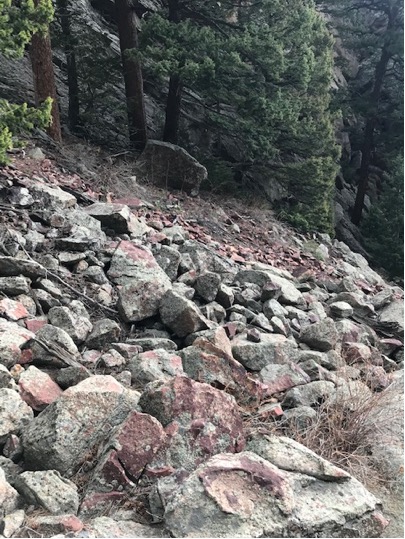
Approach as for the Southwest Face of the Goose. Once at the base of this area, traverse the scree field to the west and into a cleft between the North Face of Fiddlehead and the South face of the East Ridge.
Once past the scree field, the conditions are firm and durable pine needle covered forest floor into the cleft and the base of the route on a faint climbers/ social trail.
Looking back toward the Goose:
If different from the approach, a description of the descent, (include approximate distance from the designated trail system, existing “social” or undesignated trails, a description of the trail condition and whether there is a durable surface, such as rock. Include photographs of the descent.):
Descent from the climb is to lower back to the staging area and hiking out on the same trail as the approach.
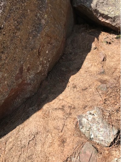
A description of the area at the base of the climb (include existing levels of soil compaction, existence of a durable surface such as rock, and existing soil erosion. Include photographs of the area at the base of the climb.):
The base and belay area are on a flat durable surface on compact dirt and pine needles. No soil erosion exists, or is expected to occur at all in this area.
Has all reconnaissance work that can be reasonably done, short of placing any hardware, been done?
All reconnaissance work has been completed.
Has the route been top roped? Is there loose rock? Is it extremely overhanging?
The route has been top roped. There is minimal loose rock. The route is slightly overhanging in a few spots, but is mostly vertical terrain.
Any additional notes:


Looks good. Be nice to have a mixed route go in.
It’s in a cool zone, so another route is welcome in my opinion. It looks a bit wandery, but that’s often how mixed routes go. I vote yes.
Took a peak while at the Goose and this panel looked like a great addition to the area!