
Route Name: Super Tuscan
Application Status: Approved
Application Cycle: 2017
Rock Formation: Seal Rock
Number of lead bolts to be placed:
Number of anchor bolts to be placed:
Route Difficulty:13-
Route Diagrams:
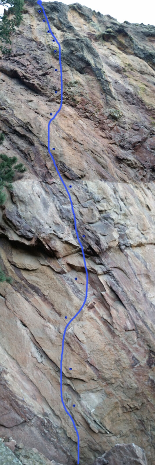
Proposed Route:
The proposed new route starts right behind a prominent block at the base of the wall and continues straight up through a small v-shaped roof, vertical faces above to a green streak left of slightly overhanging dark prow and ends above and right of a distinct vertical light-colored depression. The length of the route is about 130 ft. The line is consistent in angle, follows bands of good stone and requires minimal cleaning from loose or detached flakes. Climbing type is also consistent with good grips on edges, pockets and "nuggets" typical for this entire cliff.
Name Meaning:
Not provided
Existing Route Information
From Left (West): I am the Walrus 14a/b, Choose Life 13d, Thunder Muscle 14a, Primate 13b, The Gruffalo 11a, Skin Flute 12b, Jade Gate 11d/12a. To date, there are 7 sport (bolted) routes on the South face.Existing Route Diagrams
A description of the approach (include approximate distance from the designated trail system, existing “social” or undesignated trails leading to the climb and condition of the trail, and state whether there is a durable surface, such as rock.
The approach is via the designated but unsigned climber's trail referred to as "Harmon Cave Trail", an OSMP Trail that leaves the Mesa Trail near Bear Canyon and heads west to the eponymous cave. The trail has traditionally been used to access the south -, east- and north-face climbs. Where this trail gets to the northeast toe of the rock, a constructed trail crosses a boulders' field and climbs up to the base of the Seal Pup to a saddle at the bottom of Seal Rock's south face. From here a gently inclined gully leads up along the south face below the climbs.
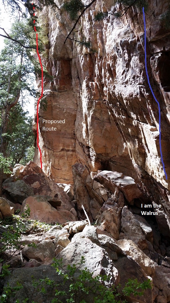
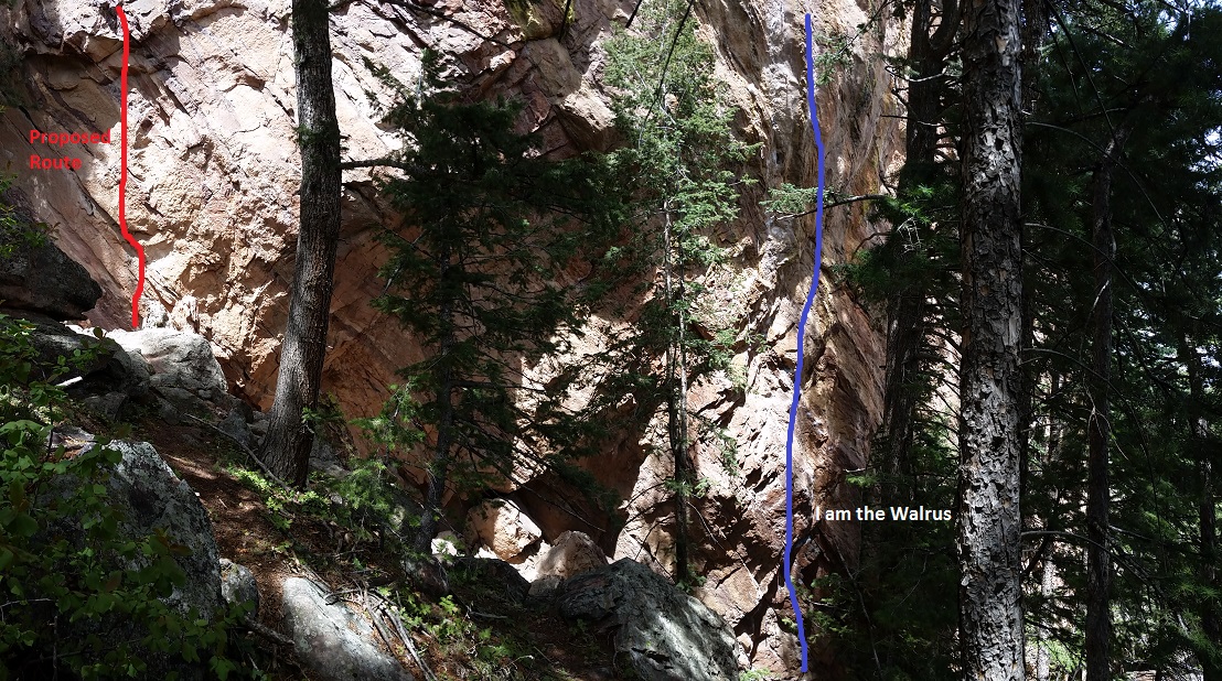
If different from the approach, a description of the descent, (include approximate distance from the designated trail system, existing “social” or undesignated trails, a description of the trail condition and whether there is a durable surface, such as rock. Include photographs of the descent.):
The descent will be via a lower-off from the top of the climb, which deposits you back on the big rock at the starting point of the climb.
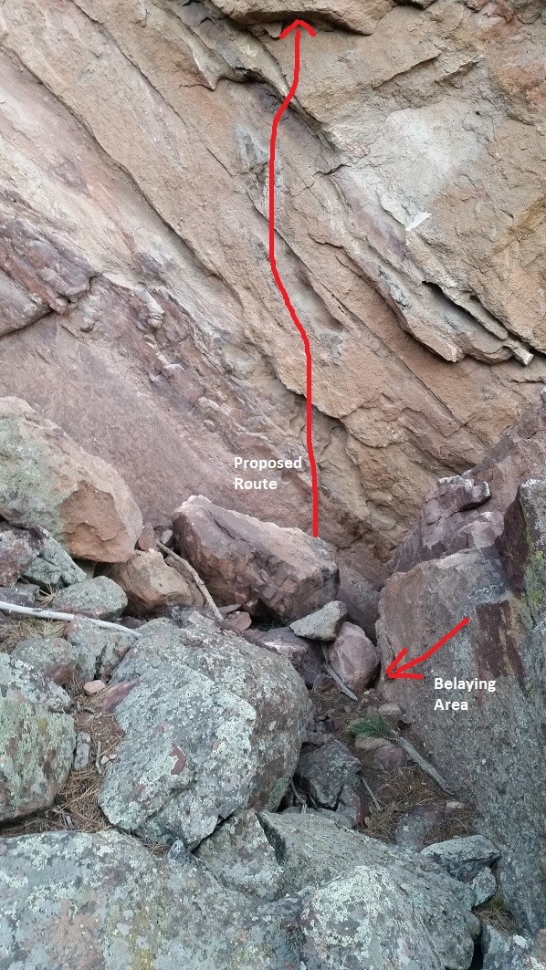
A description of the area at the base of the climb (include existing levels of soil compaction, existence of a durable surface such as rock, and existing soil erosion. Include photographs of the area at the base of the climb.):
The staging area at the base of the climb is comprised of boulders' field with a flat surface in between with compact soil with no vegetation. The area is well contained with no potential for erosion. There is one large boulder slightly to climber's right of the start of the route. The route would start straight from a smaller boulder.
Has all reconnaissance work that can be reasonably done, short of placing any hardware, been done?
Base Area Photos
Has the route been top roped? Is there loose rock? Is it extremely overhanging?
No top rope climbing has been done yet due to the length and steepness of the line. There were no placements for directional gear which made it hard to stay close to the rock. Majority of moves will be able to be done only after bolts are placed. The rock quality is very good, clean and compact sandstone/conglomerate mixed with bands of solid brown rock on almost entire line. It is expected that a few loose and small flakes on the lower part of the climb would need to be removed for safety. Upper half of the route has good quality stone.
Any additional notes:
The proposal for a new climb on South face of Seal Rock, with temporary reference name "Super Tuscan", is located in the upper part of that wall, about 50 ft up the slope and West from existing route "I am the Walrus".
News and Events
 Seal Rock Trail DayOctober 9, 2026 - 2:46 pm
 Trail Day at Seal Rock October 3September 15, 2026 - 8:37 am
 26th Annual Flagstaff Trash Bash ReportSeptember 6, 2026 - 2:46 pm
 Join FCC at the 26th Annual Trash Bash September 3August 1, 2026 - 11:47 am
 From Boulder OSMP “Seasonal area closures have been lifted”July 30, 2026 - 3:48 pm
 OSMP/FCC Trail Day at The Slab: Trip ReportJuly 27, 2026 - 2:59 pm


13 minus?! May it be so. This route should be approved.
Looks good to me! Equip this route.
I vote Yes
Derek is well known for quality routes
Yes.
Looks like a nice addition. Yes.
Doesn’t appear to be crowding other lines, and looks clean. Should be approved.