Route Name: Eggsistential Crisis
Application Status: Approved
Application Cycle: 2022
Rock Formation: The Goose Eggs
Number of lead bolts to be placed: 6
Number of anchor bolts to be placed: 2
Route Difficulty:5.12
Route Diagrams:
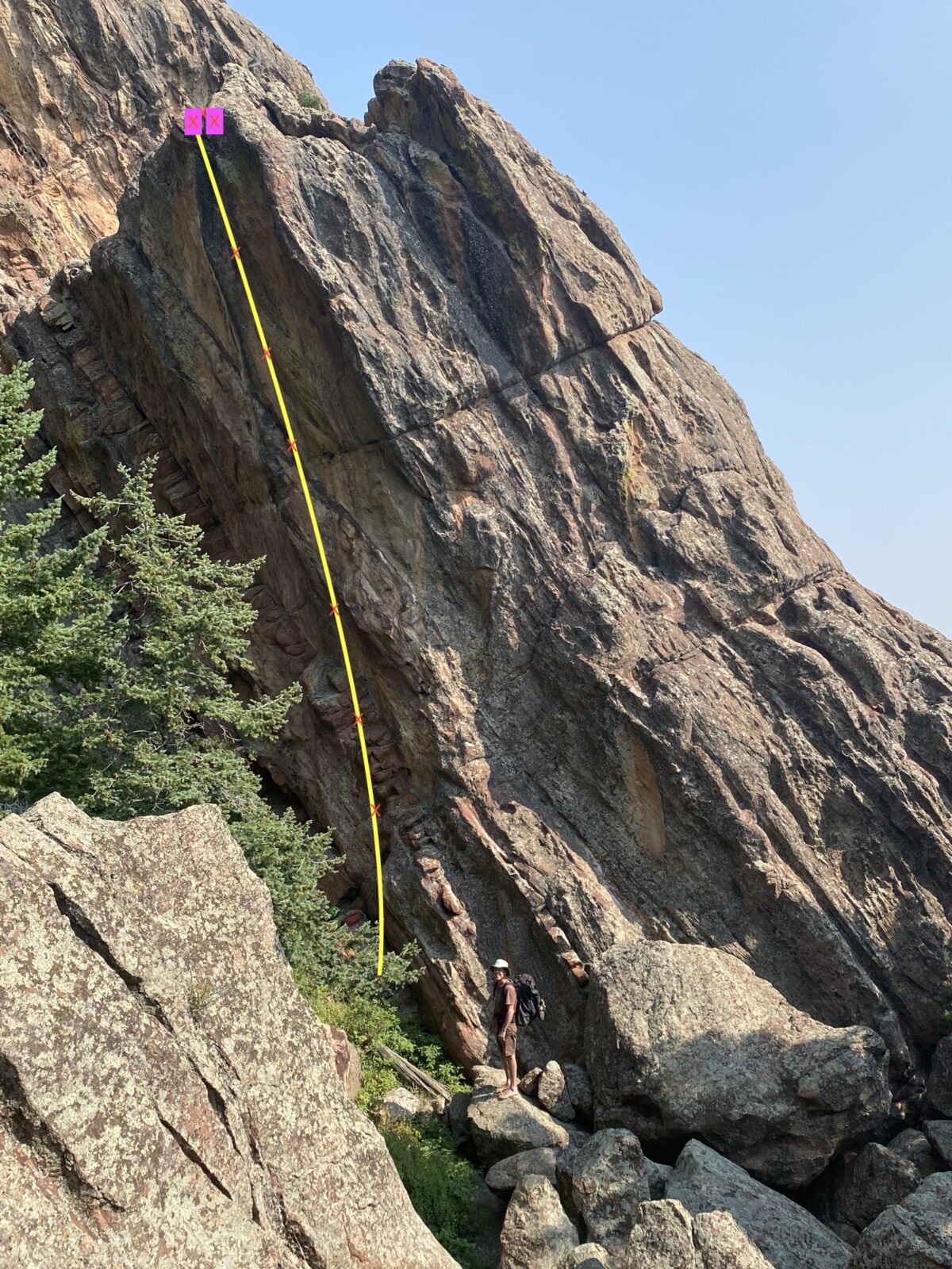
Proposed Route:
The proposed route goes up the steep SW corner of the formation. This is the formation just North of the Southern Goose Egg.
Name Meaning:
The name is a fun play on words: “existential crisis” to Eggsistential Crisis for the Goose Eggs.
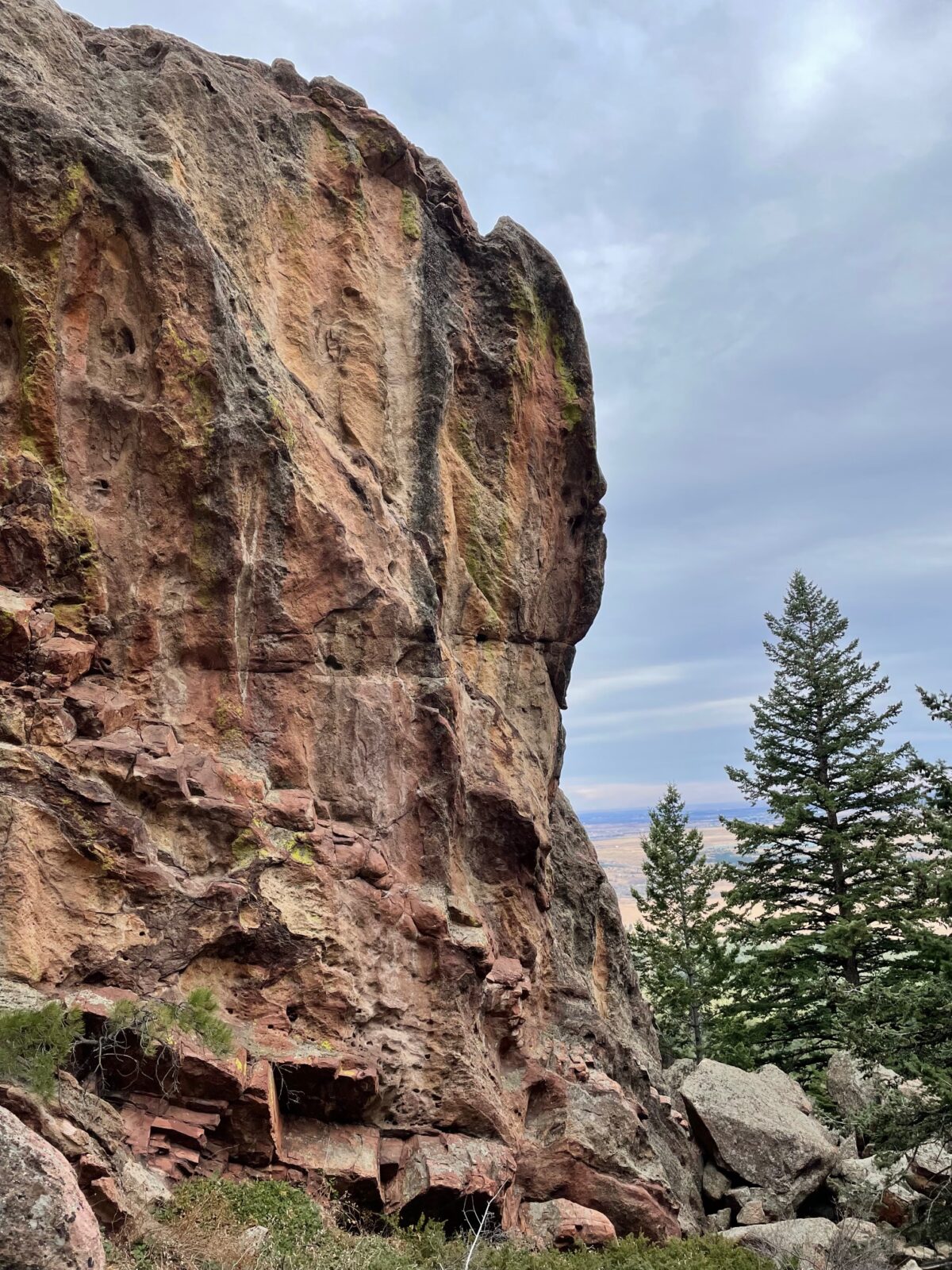
Existing Route Information
There are no other routes on this face of this formation. It is the right side of an overhanging west face, of a formation possibly called the Smallest Egg? (it is very unclear in the Haas guidebook). The Southern Goose Egg has The Sea and the Mirror 5.10c, Fruity Pebbles 5.9, Power Bacon 5.10a, South Ramp 5.1, and Rude Welcome 5.11c. The other Goose Eggs are defined by their East Face routes, which are: Broken Egg East Face 5.2. Smallest Egg East Face Class 4, Northern Egg East Face at 5.3.Existing Route Diagrams
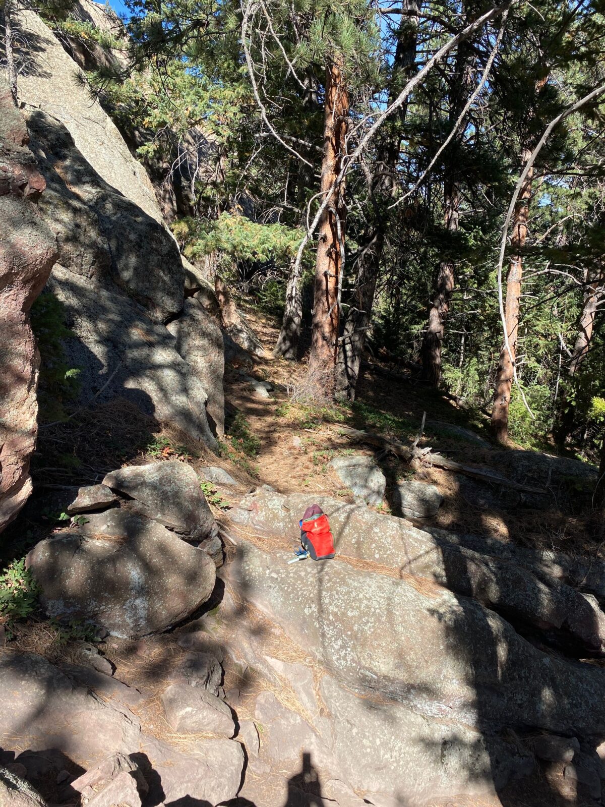
A description of the approach (include approximate distance from the designated trail system, existing “social” or undesignated trails leading to the climb and condition of the trail, and state whether there is a durable surface, such as rock.
From the intersection and signpost of the two trails that lead into Fern Canyon (one from Shanahan area, and one from Bear Canyon area), walk west on the Fern Canyon trail another 100 feet, then turn right or north along a very faint track, heading north for about 200 feet. Head west now, up one of the gullies, which will involve some easy scrambling, and searching for the easiest way. After about 5 minutes or 250 feet up and west in these gullies and/or easy slabs, you will enter a flatter area, surrounded by the Goose Eggs; a collection of smallish (50 foot tall) formations The surface of this scramble is mostly rock, and pine needle covered ledges.

If different from the approach, a description of the descent, (include approximate distance from the designated trail system, existing “social” or undesignated trails, a description of the trail condition and whether there is a durable surface, such as rock. Include photographs of the descent.):
Descent from the climb is to lower back to the staging area and hiking out on the same trail as the approach.
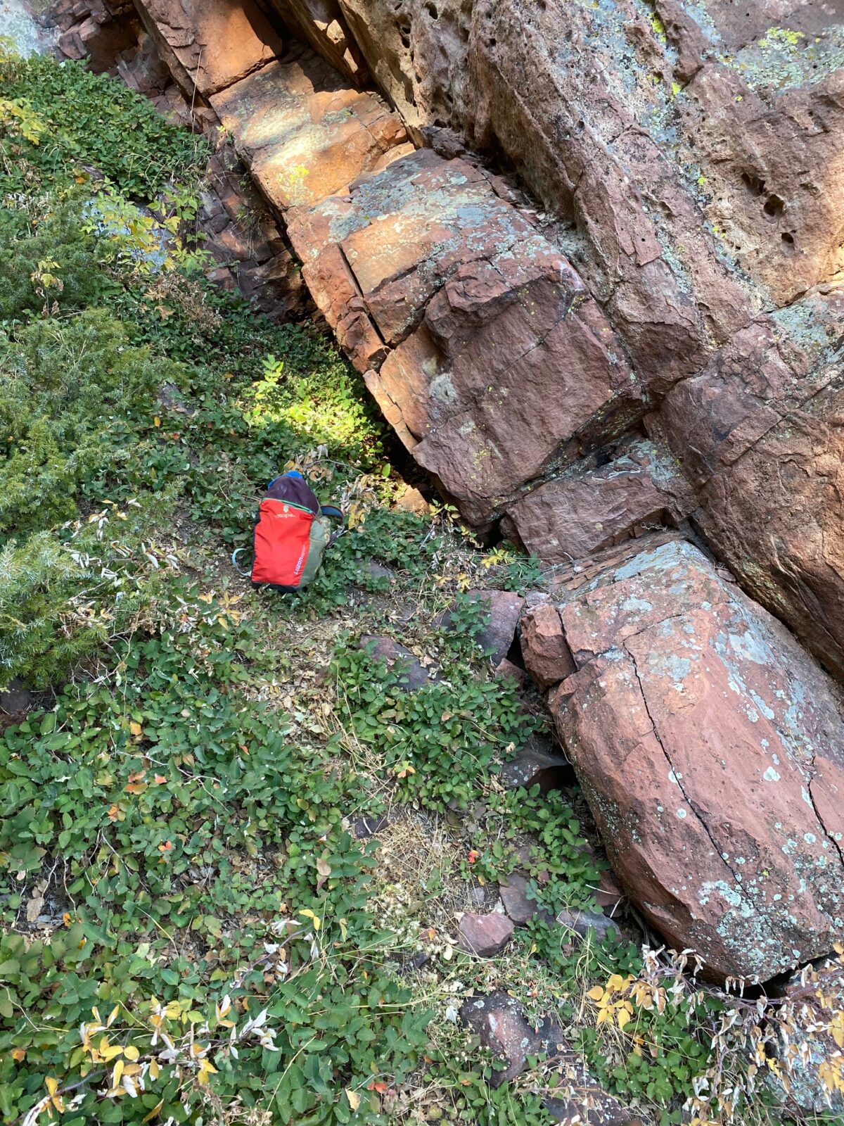
A description of the area at the base of the climb (include existing levels of soil compaction, existence of a durable surface such as rock, and existing soil erosion. Include photographs of the area at the base of the climb.):
The base area is flat, with durable surfaces and low vegetation.
Has all reconnaissance work that can be reasonably done, short of placing any hardware, been done?
Base Area Photos
Has the route been top roped? Is there loose rock? Is it extremely overhanging?
We have successfully top-roped the route, and free climbed all parts of it. There is very little loose rock. The route overhangs perhaps 10 feet, in its 50-foot height.
Any additional notes:
Not provided
News and Events
 OSMP/FCC Trail Day at The Slab: Trip ReportJuly 27, 2026 - 2:59 pm
 FCC/OSMP Trail Volunteer Day at the Slab July 25July 7, 2026 - 10:59 am
 2025 Flagstaff Trash Bash – September 4July 30, 2025 - 5:31 pm
 Trail Volunteer Day – Hillbilly Crag, October 26, 2024September 29, 2024 - 4:00 pm
 Golden Eagle Closures – New PeriodNovember 27, 2022 - 12:54 pm
- Trail Volunteer Day – First Flatiron, September 24August 24, 2022 - 10:54 am


This is a cool little pillar; looked at it years ago and always thought it needed a route. I vote yes!
Looks and sounds really cool. Yes please!
Looks like a fun route
Looks like a fun line in a cool location. I vote yes.
This area always looks amazing from the Slab, looks even better up close! Nice find, I’m all for it.