
Route Name: Release the Hostages
Application Status: Approved
Application Cycle: 2018
Rock Formation: Overhang Rock
Number of lead bolts to be placed: 14
Number of anchor bolts to be placed: 2
Route Difficulty:5.13
Route Diagrams:
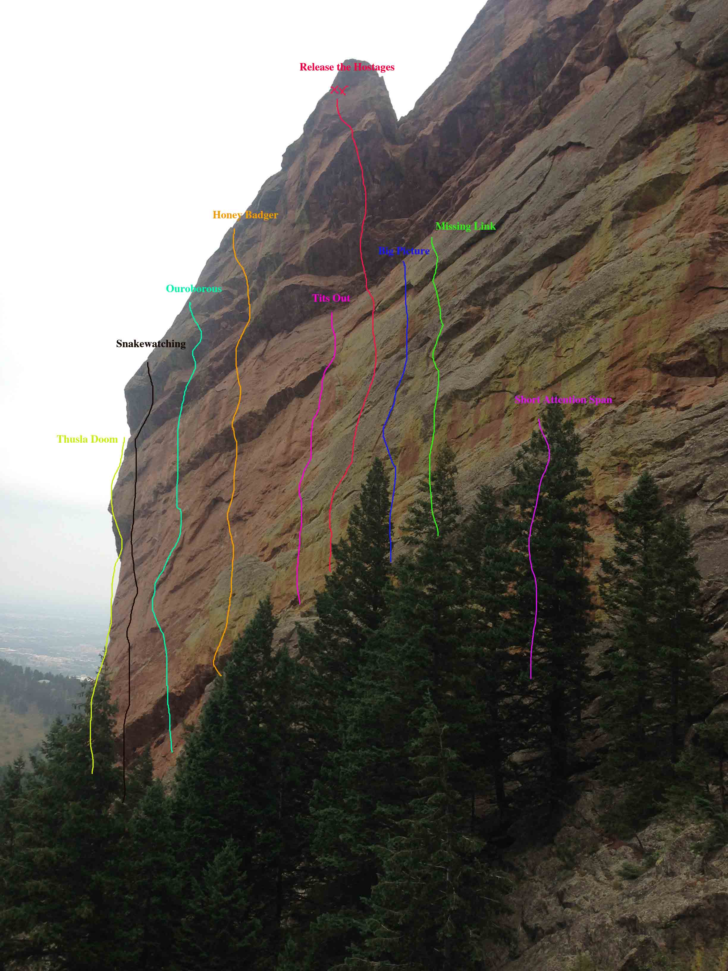
Proposed Route:
Proposed route, Release the Hostages (5.13, 35 meters), is an entirely independent line on the west face of Overhang Rock in Bear Canyon. After 25 meters of vertical 5.12/12+ climbing, the route tackles the largest section of overhanging stone (~5.13) capping the wall directly above the lower face climbing.
Name Meaning:
Not provided
Existing Route Information
There are 10 established climbs (8 sport, two traditional) on the west side of Overhang Rock. Proposed route is located between Tits Out for the Lads (5.12b), and The Big Picture (5.12/b), with approximately 4 meters of separation on either side.Existing Route Diagrams
A description of the approach (include approximate distance from the designated trail system, existing “social” or undesignated trails leading to the climb and condition of the trail, and state whether there is a durable surface, such as rock.
Approach is via the Bear Canyon Trail to the Overhang Rock climber's trail, which leaves the Bear Canyon Trail at a point directly south of Ridge Three in Bear Canyon. The base of the west face of Overhang Rock is reached in less than 10 minutes from the Bear Canyon Trail.
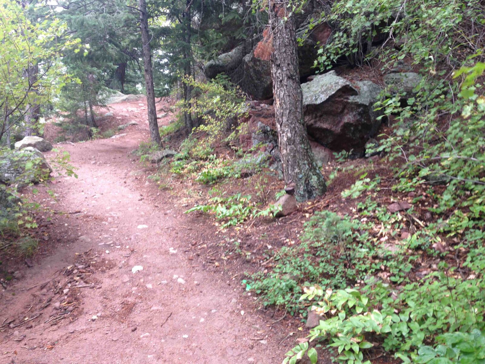
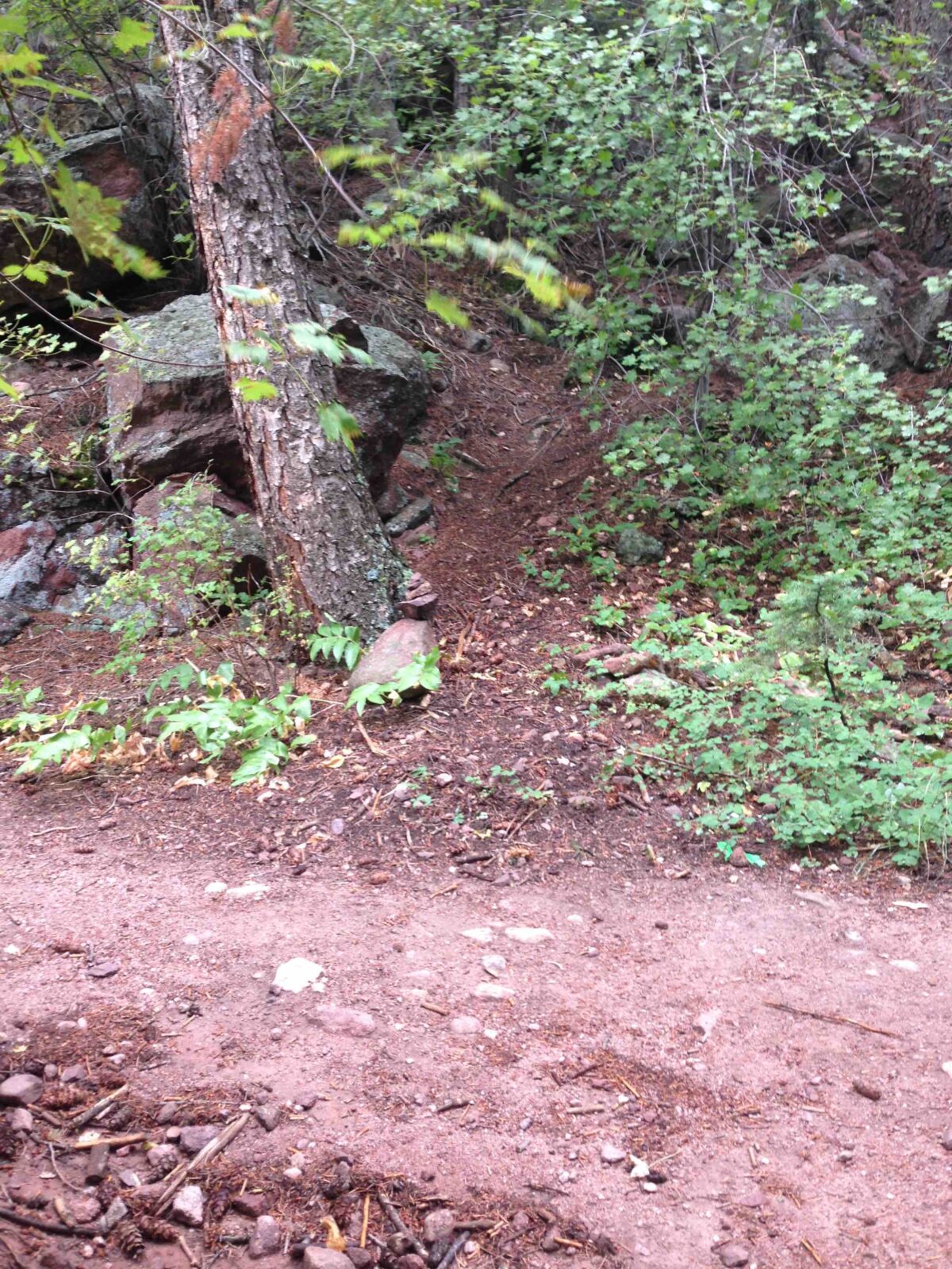
If different from the approach, a description of the descent, (include approximate distance from the designated trail system, existing “social” or undesignated trails, a description of the trail condition and whether there is a durable surface, such as rock. Include photographs of the descent.):
Descent via the approach trail.
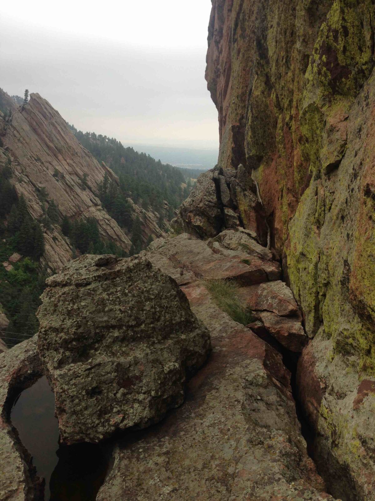
A description of the area at the base of the climb (include existing levels of soil compaction, existence of a durable surface such as rock, and existing soil erosion. Include photographs of the area at the base of the climb.):
Tits Out for the Lads (5.12b), Release the Hostages, The Big Picture (5.12b) and Missing Link (5.12c) all share the same staging area: a bare rock ledge 8 meters above the base of the cliff. This ledge is reached via an easy scramble on its right/south end.
Has all reconnaissance work that can be reasonably done, short of placing any hardware, been done?
Base Area Photos
Has the route been top roped? Is there loose rock? Is it extremely overhanging?
Route has not been toproped in its entirety due to steepness and lack of directional protection.
Any additional notes:
Not provided
News and Events
 Seal Rock Trail DayOctober 9, 2026 - 2:46 pm
 Trail Day at Seal Rock October 3September 15, 2026 - 8:37 am
 26th Annual Flagstaff Trash Bash ReportSeptember 6, 2026 - 2:46 pm
 Join FCC at the 26th Annual Trash Bash September 3August 1, 2026 - 11:47 am
 From Boulder OSMP “Seasonal area closures have been lifted”July 30, 2026 - 3:48 pm
 OSMP/FCC Trail Day at The Slab: Trip ReportJuly 27, 2026 - 2:59 pm


Uniquely steep for this wall, and independent. This should be approved.
Oooh yea. Me likey.