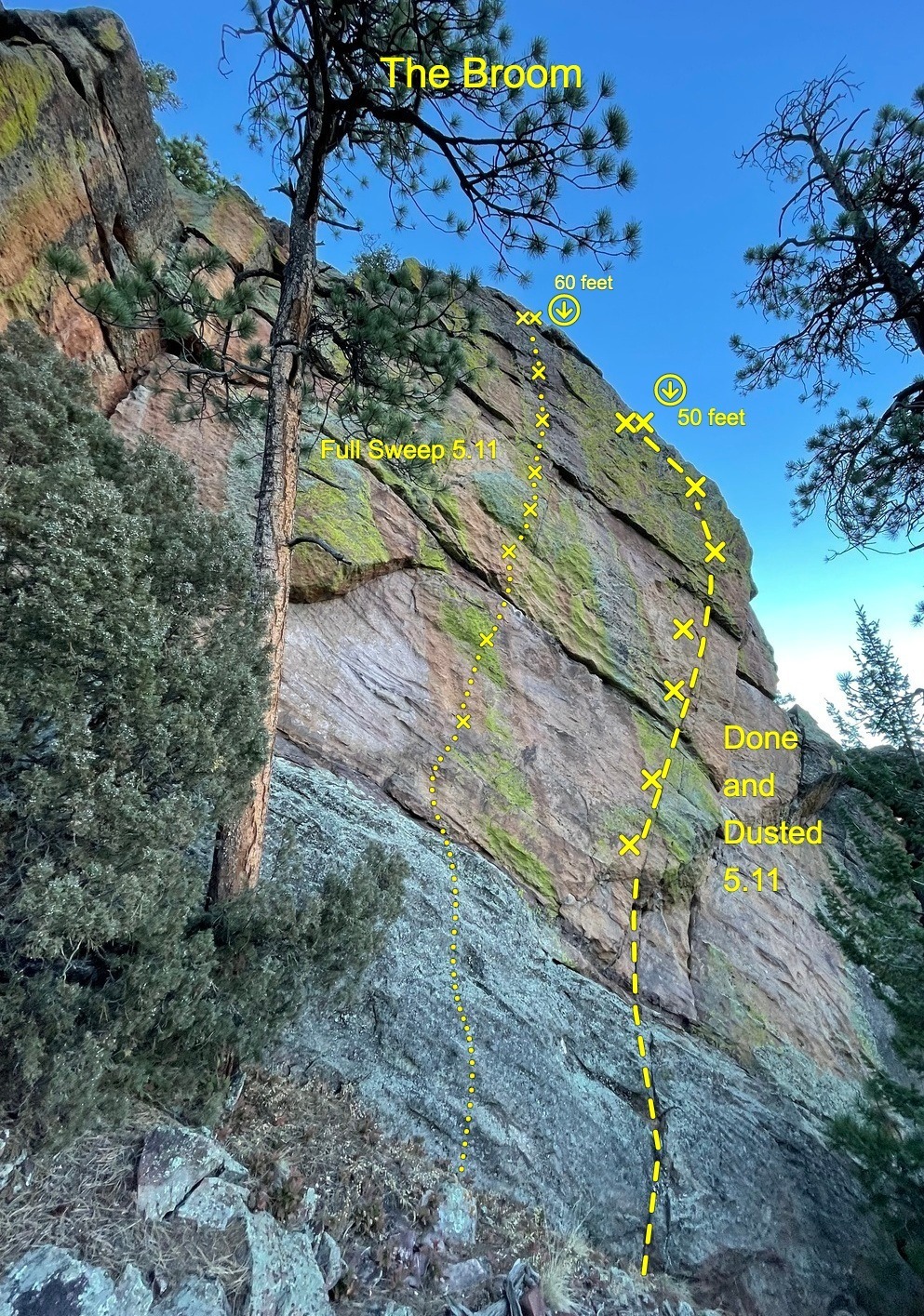
Done and Dusted
Route Name: Done and Dusted
Rock Formation: The Shanahan Crag
Number of bolts to be placed: 6 bolts + 2 bolt anchor
Route Difficulty: 5.11+
Route Description:
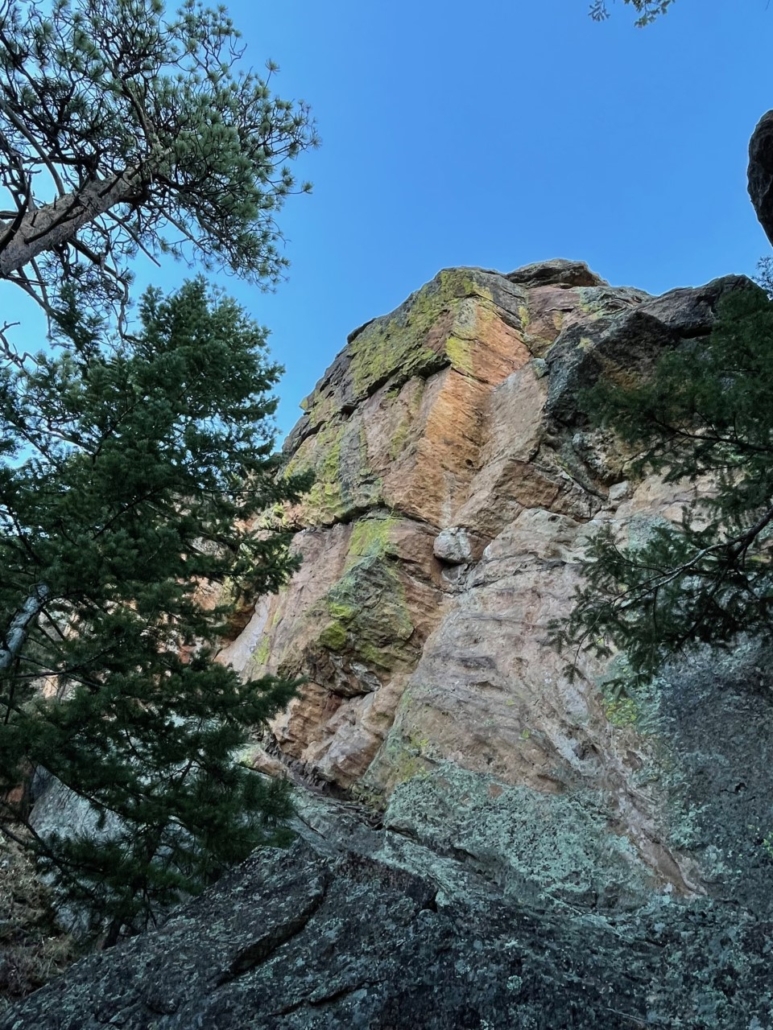
This route is short but sweet. More powerful than it’s neighbor, Clean Sweep, this new proposal would be a fun addition to “The Broom.” Easy moves lead to the first clip and the first crux. Steep and awkward moves follow seams up a steep tilted arete. The seams look like they should have gear placements, but they don’t!
We named this formation “The Broom” after a dust broom found on the summit. This name “Done and Dusted” is keeping with the broom theme, but it is also a phrase from a book called Barbarian Days, by William Finnigan.
A description of existing routes on the same face of the rock formation, including the number of routes, route names, route grade, type, and approximate distance between routes (a photocopy or diagram of the existing route(s) is also required):
Most of the existing routes at the Shanahan crags are on the South face of the Central crag. This formation is a South facing wall just North of the summit of the Central crag. There is one documented route here “Clean Sweep” as well as two trad routes up the east face of the eastern part of the North Shanahan crag.
A description of the approach (include approximate distance from the designated trail system, existing “social” or undesignated trails leading to the climb and condition of the trail, and state whether there is a durable surface, such as rock.
There are many ways to reach this crag. Many have seen this wall along their descent from the East Face of the Central Crag, as the walk off trail passes under it. The best way to access this climb is from the North Fork of the Shanahan Ridge trail. When you reach The Slab, hang a left and follow a climber trail South. You can then choose to go up one of two gullies, the second gully is probably the easiest. This face is near the top of the gully and facing South.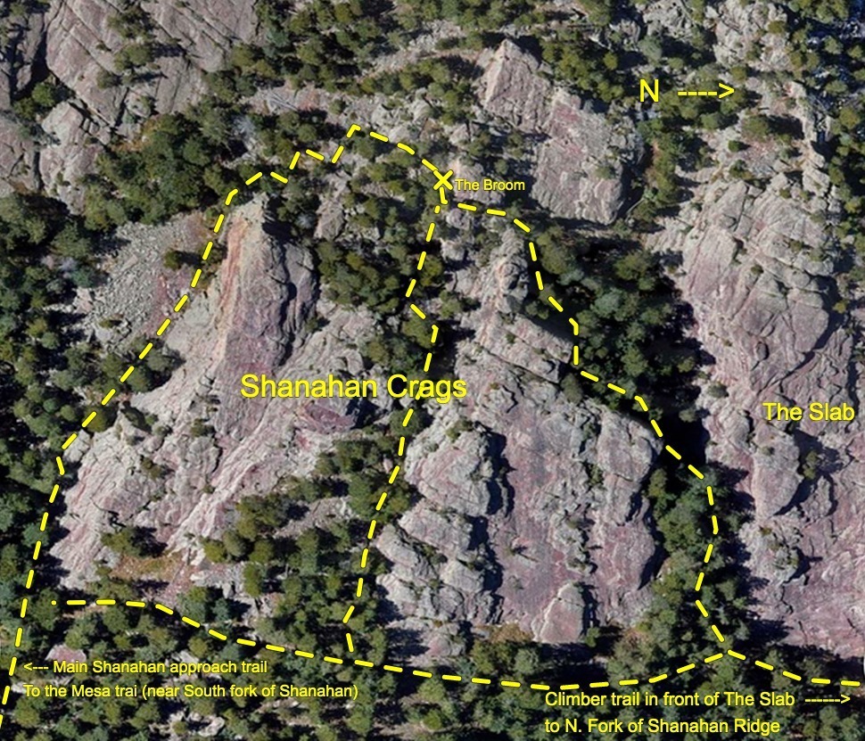
If different from the approach, a description of the descent, (include approximate distance from the designated trail system, existing “social” or undesignated trails, a description of the trail condition and whether there is a durable surface, such as rock. Include photographs of the descent.):
To descend from the route, lower from the anchor and reverse the approach to the trailhead.
Staging area:
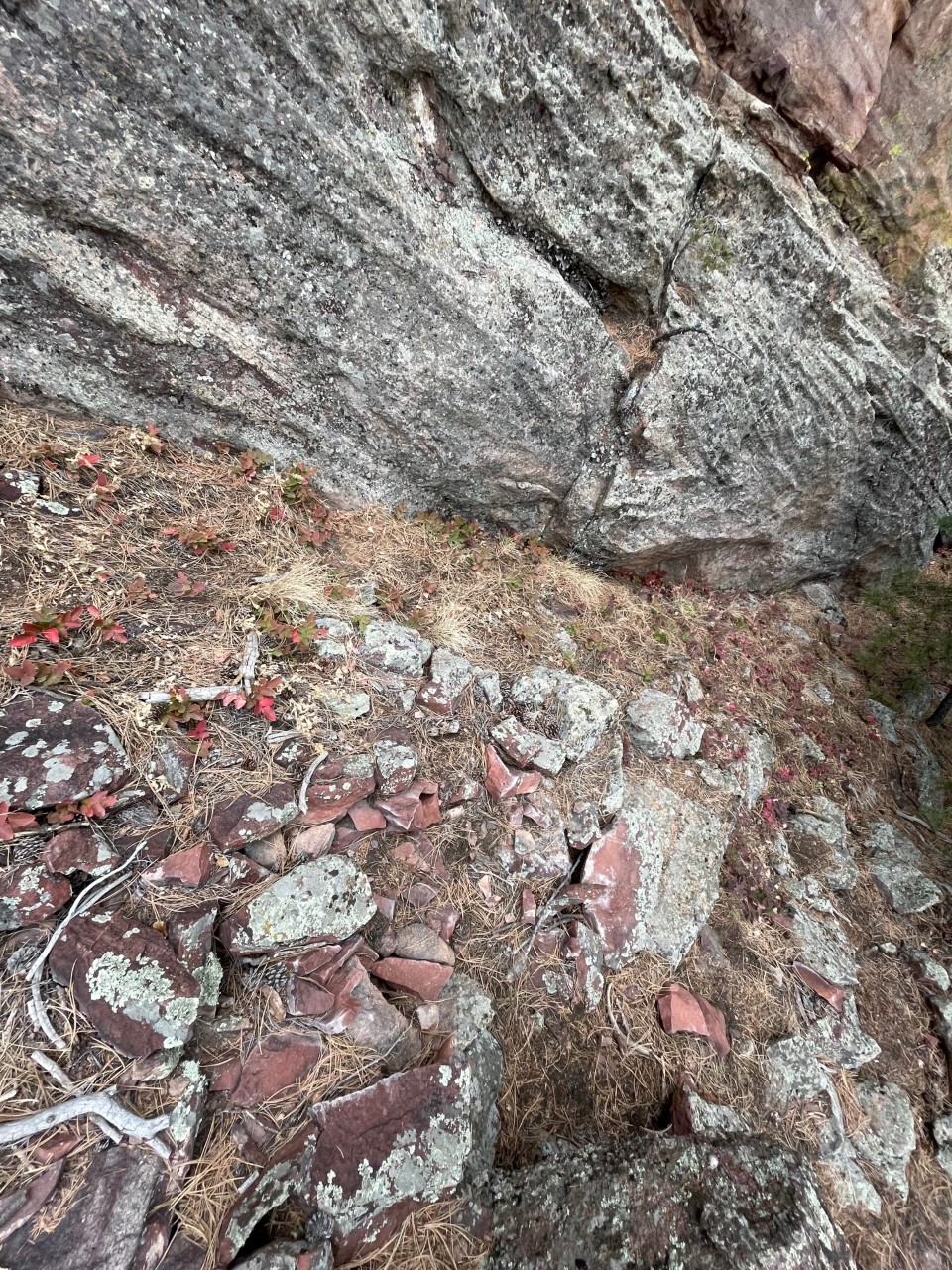
A description of the area at the base of the climb (include existing levels of soil compaction, existence of a durable surface such as rock, and existing soil erosion. Include photographs of the area at the base of the climb.):
The staging area is mostly flat with some rocks and pine needles.
Has all reconnaissance work that can be reasonably done, short of placing any hardware, been done?
Reconnaissance is complete.
Has the route been top roped? Is there loose rock? Is it extremely overhanging?
The route has been top roped at a grade of 5.11+
Any additional notes:
This would make a nice addition to the other route on this wall.


Looks like a fun, high-quality addition to the area. I vote yes.
Looks like a good addition to the zone and will make the hike up to this upper wall more worth the effort, with a second climb. I say yes.