Negative Space
Route Name: Negative Space
Rock Formation: The Third Flatiron (North Face)
Number of bolts to be placed: 20-lead bolts + 2 (2 bolt anchors)
Route Difficulty: 5.14
Route Description:
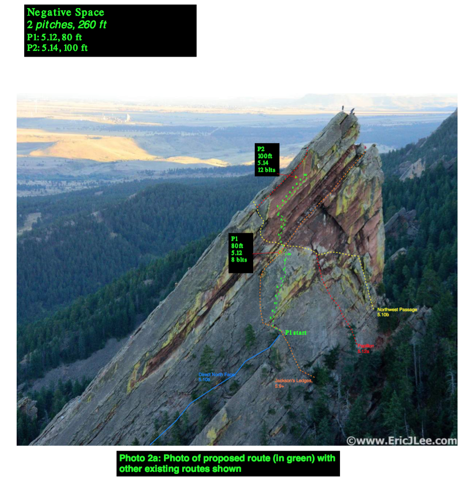
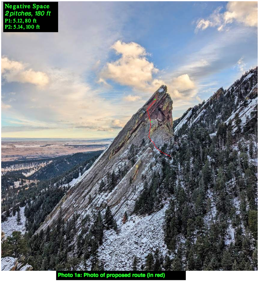
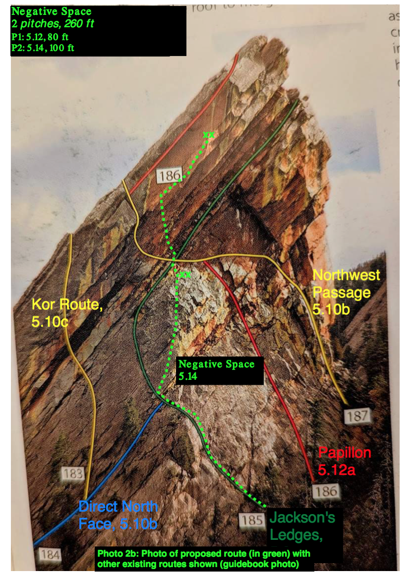
The proposed route ascends the north face of the Third Flatiron, and is comprised of 2 pitches. The route starts at the base of the North face on the first 50 ft of Jackson’s Ledges. This section is 4th class with about 20 ft of low 5th class. When Jackson’s Ledges traverses a ledge / bulge to the left (east), the proposed route goes straight up. The first bolts will be placed here (out of reach of Jackson’s Ledges). The first pitch goes through lower angle rock and terminates just below a ledge shared with four existing routes. The pitch is approximately 5.12a.
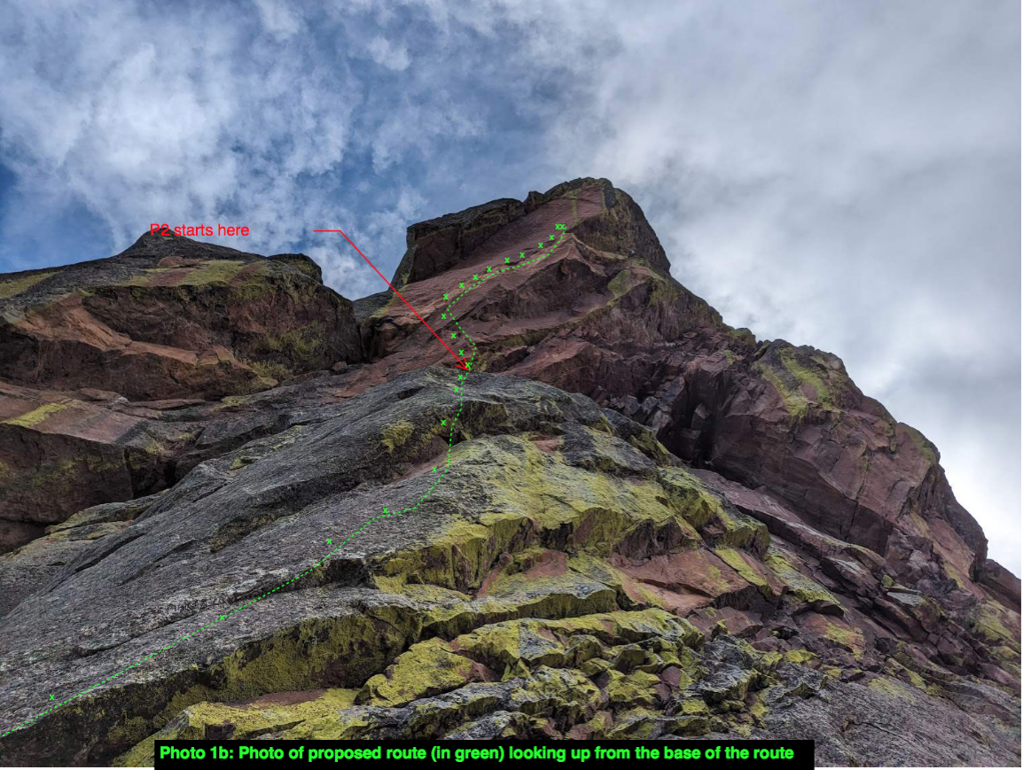
From this anchor, the second pitch goes straight up, crossing the Northwest Passage and Jackson’s Ledges, and ascending the steep blocky wall towards the angled headwall. The route follows the rising headwall up and right (west), paralleling the crack of Papillon about 25 – 30 ft below it. Below the rising traverse is a large overhanging roof. The second pitch terminates at the end of a 5.14 crux sequence. The second pitch anchor will allow climbers to lower back to the P1 ledge or rappel the route.
The route name, Negative Space, refers to the empty space around the subject of an image. The name summarizes the way that the line appears from afar, as there is a large roof under and over the p2 crux, forming a negative space framework around the route. The crux is also climbed using the features of the rock, which can be thought of as the negative space around the face itself.
A description of existing routes on the same face of the rock formation, including the number of routes, route names, route grade, type, and approximate distance between routes (a photocopy or diagram of the existing route(s) is also required):
Existing routes on the north face of the third flatiron, in the vicinity of the proposed route, include:
-
-
Direct North Face, 5.10b, traditional
-
Jackson’s Ledges, 5.9+, traditional
-
Papillon, 5.12a, traditional
-
Northwest Passage, 5.10b, traditional
No bolts will be placed on shared terrain with existing traditional routes. The proposed route shares the first 50 ft of Jackson’s Ledges, which is low fifth class. No bolts will be placed here. The first pitch then ascends completely independent terrain about 25 – 30 ft to the right (west) of Jackson’s Ledges / Direct North Face. The pitch terminates below a ledge shared by all 4 routes.
-
The second pitch crosses each of the existing routes in a single location on the ledge, and then ascends straight up and right on independent terrain. The first bolt will be placed out of reach of the existing routes. The second pitch parallels the existing route Papillon, about 25 – 30 ft below the crack. Bolts will not be within reach of climbers on Papillon.
-
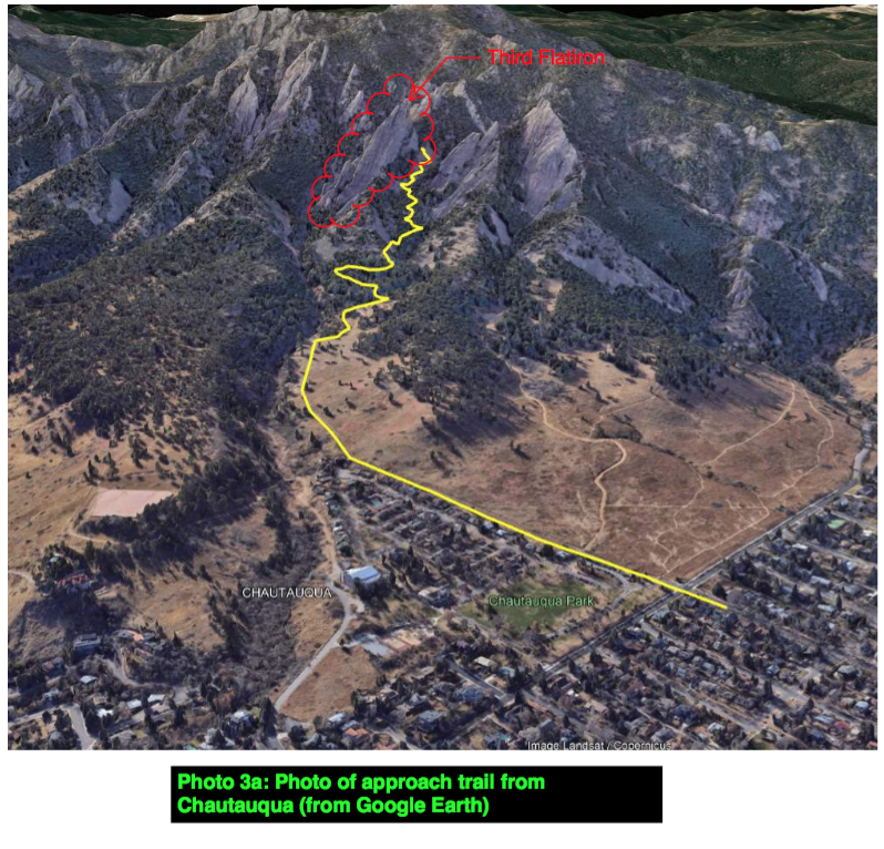
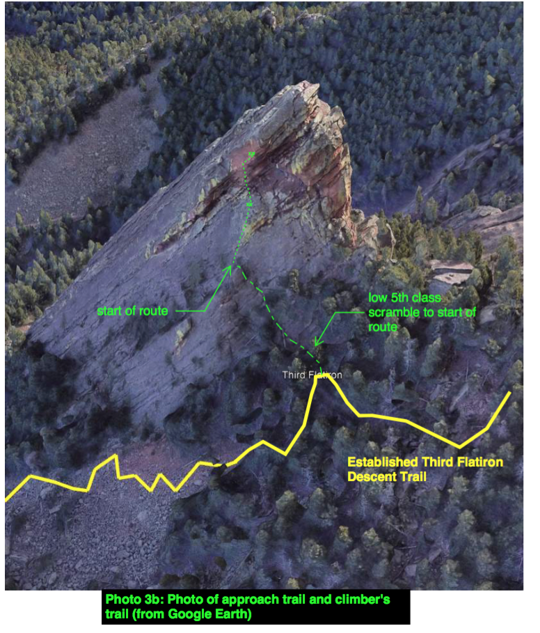
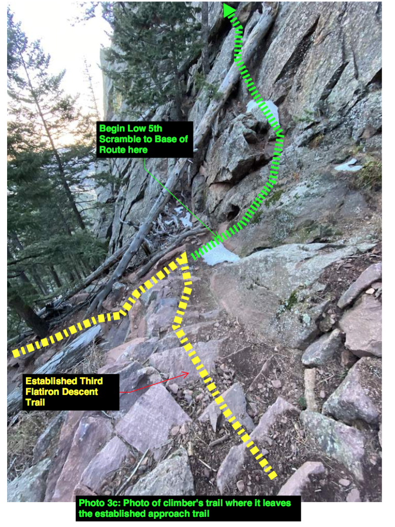
A description of the approach (include approximate distance from the designated trail system, existing “social” or undesignated trails leading to the climb and condition of the trail, and state whether there is a durable surface, such as rock.
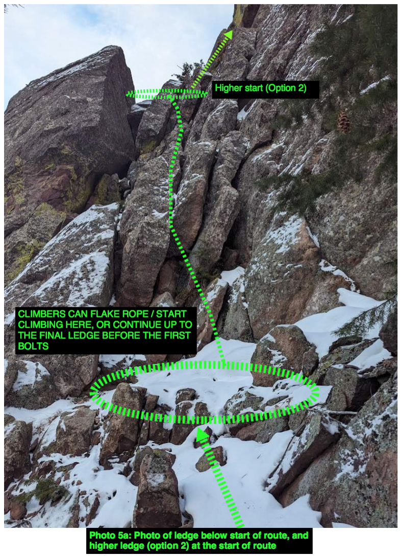
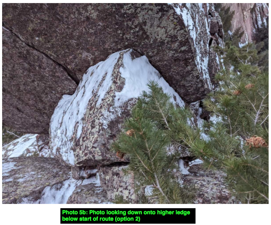
The approach starts at Chautauqua Park and follows the Flatirons Loop trail. The approach then goes up the well-established third flatiron descent trail through the talus field north of the formation. When the trail meets the wall, climbers can begin scrambling up the low fifth class to a nice ledge at the base of the first pitch. Climbers can choose to rope up for the last 20 ft of the approach scramble, which is low 5th class, or continue scrambling to a smaller, higher ledge just before the first bolt.
If different from the approach, a description of the descent, (include approximate distance from the designated trail system, existing “social” or undesignated trails, a description of the trail condition and whether there is a durable surface, such as rock. Include photographs of the descent.):
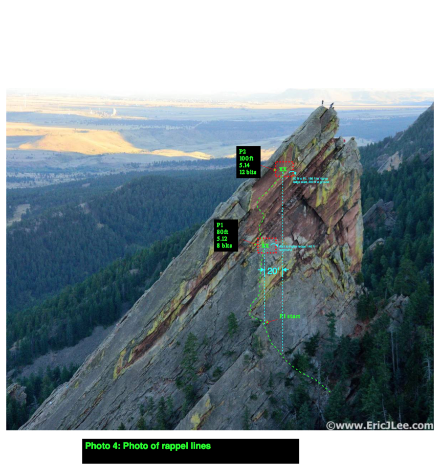
Climbers descend by rappelling the route. See attached photo 4 for information on rappelling. 70m rope required.
From the P2 anchor, it is about:
o 80 ft (and 20 ft sideways) to the P1 anchor
o 180 ft (and 20 ft sideways) to the higher start ledge
o 200 ft to the ground straight down
If projecting P2, climbers can lower back to the P1 ledge. If cleaning, climbers can rappel straight to the ground with 2x 60m ropes, or down using P1 with 1x 70m rope
From the P1 anchor, it is about:
o 80 ft to the higher start ledge
o 100 (and 20-30 ft sideways) to the ground below the fifth class section
Once on the ground climbers can simply walk down the same way they came up.
A description of the area at the base of the climb (include existing levels of soil compaction, existence of a durable surface such as rock, and existing soil erosion. Include photographs of the area at the base of the climb.):
Climbers will leave the established trail by stepping directly onto rock that forms the base of the north face of the Third Flatiron. No erosion issues are anticipated. The end of the low fifth class scramble ends at a rock ledge – no soil / vegetation exists here at the base of the route.
See attached photo 5a of lower ledge below climb, and photo 5b of higher ledge. Either ledge can be used to start climbing. Both locations are fully compacted sand or rock, with no vegetation or erosion concerns.
Has all reconnaissance work that can be reasonably done, short of placing any hardware, been done?
Yes – the route has been climbed on top rope and preliminary bolt locations have been identified. Bolt locations will be modified / refined during the bolting process.
Has the route been top roped? Is there loose rock? Is it extremely overhanging?
Yes – all of the moves have been free climbed on P1. Almost all of P2 has been freed, save for a couple moves. The severe overhanging and traversing nature of P2 makes it very difficult to climb without bolts in place.
P1 is low angle with no loose rock. Start of P2 has some minimal loose rock as you cross the existing trad routes, but then is entirely free of loose rock for the upper part. P2 is mostly overhanging.
Any additional notes:


A beautiful line. Interesting and challenging. I vote yes!